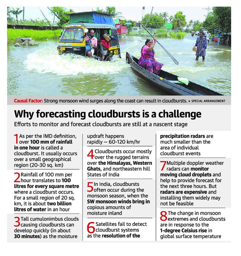
Why cloudburst forecast in India still remains elusive
- Cloudbursts are violent and voluminous amounts of rain pouring down in a short duration over a small area have been reported since the mid-19th century.
- Yet, the characteristics of these events remain elusive, and our efforts in monitoring and forecasting them are at an embryonic stage.
Cloudbursts
- Associated with cumulonimbus clouds that cause thunderstorms
- Occasionally due to monsoon wind surges and other weather phenomena.
Characteristics
- Do not indicate clouds exploding.
- Defined by the amount of rainfall.
- As per IMD, it amounts to 100 mm of rain in an hour.
- Occur over a small geographical region of 20 to 30 sq. km.
- Strong monsoon wind surges along the coast can also result in cloudbursts.
- Eg. Mumbai (2005) and Chennai (2015).
Mechanism
- Often occur during the monsoon season, when the southwesterly monsoon winds bring in copious amounts of moisture inland.
- Moist air that converges over land gets lifted as they encounter the hills.
- Reaches an altitude and gets saturated
- Water starts condensing out of the air forming clouds
- Orographic lifting together with a strong moisture convergence can lead to intense cumulonimbus clouds taking in huge volumes of moisture.
- A single-cell cloud may last for an hour and dump all the rain in the last 20 to 30 minutes
- Some merge to form multi-cell storms and last for several hours.
Cloudburst prone areas
- Occur mostly over the rugged terrains over the Himalayas, the Western Ghats, and northeastern hill States of India.
- Rain on the fragile steep slopes trigger landslides, debris flows, and flash floods.
- Causes large-scale destruction and loss of people and property.
- Reported from the NE States and Western Ghats States during the current monsoon season (2022).
Challenges in detecting cloudbursts
- Resolution of the precipitation radars of satellites can be much smaller than the area of individual cloudburst events.
- So, they go undetected.
- Weather forecast models also face a similar challenge in simulating the clouds at a high resolution.
- Skillful forecasting of rainfall in hilly regions remains challenging due to:
- uncertainties in the interaction between the moisture convergence and the hilly terrain
- the cloud microphysics
- the heating-cooling mechanisms at different atmospheric levels.
- Multiple doppler weather radars effective to monitor moving cloud droplets.
- Expensive affair
- Installing them across the country may not be practically feasible.
Measures
- Mapping the cloudburst-prone regions using automatic rain gauges.
- If cloudburst-prone regions are co-located with landslide-prone regions, these locations can be designated as hazardous.
- People should be moved
- Construction and mining in nearby regions should be restricted
Climate change and global warming
- Climate change is projected to increase the frequency and intensity of cloudbursts worldwide.
- As the air gets warmer, it can hold more moisture and for a longer time.
- A 1-degree Celsius rise in temperature may correspond to a 7-10% increase in moisture and rainfall.
- This increase in rainfall amount does not spread moderately throughout the season.
- As the moisture holding capacity of air increases, it results in prolonged dry periods intermittent with short spells of extreme rains.
- More deeper cumulonimbus clouds form and the chances of cloudbursts also increase.

